Click to download now, finish the installation quickly, and directly unlock the all-round experience
What it does
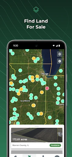
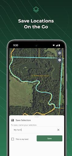
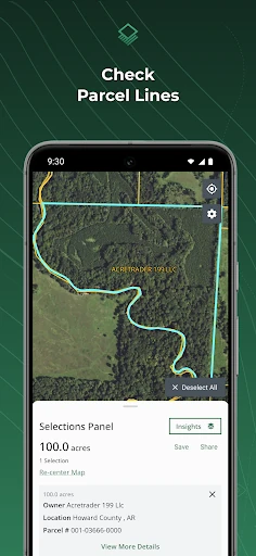
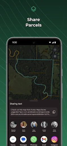
Find and analyze land on-the-go with Acres’ land research app, the ultimate tool for landowners, farm managers, and land real estate professionals. Quickly check parcel property lines, owner info, and more while on location. Browse millions of US parcels with 7 filters, including soil maps, elevation, and crop history. Easily save parcels while on location and share maps from the app.
◆ NO ADS
◆ SEARCH LAND FOR SALE
• Find and share land listings across the US.
◆ FIND OWNER NAMES AND PROPERTY LINES
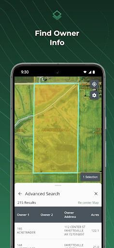
• Property Lines: Check property boundaries.
• Owner Info: Upgrade to Acres+ to view landowner names.
◆ ACCESS AND SHARE LAND DATA
• Save parcels so you can reference them anytime.
• Easily share maps and land data from the app.
• Share your location to access land data on-site.
• Download offline maps and drop a pin to share your location.
◆ RESEARCH LAND ON THE GO
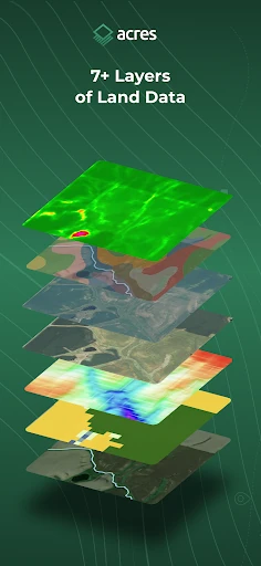
Select a parcel, view property lines, and evaluate land data, including:
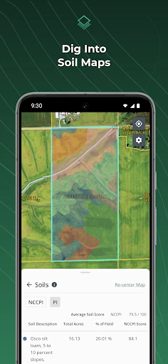
• Soil Maps: Soil composition and quality.
• Elevation: Quickly check the range of elevation.
• Vegetation Index: Plant health based on light wave reflection.
• Crop History: Annual crop coverage gathered via satellite imagery.
• County Rent: Estimates for cash rental rates for cropland and pastureland.
• County Yield: Farmer-reported survey data of annual expected crop yields.
• Property Tax: Recent property taxes where available.
◆ FEEDBACK AND SUPPORT
Request new features or get help from our team at: [email protected]

◆ NO ADS
◆ SEARCH LAND FOR SALE
• Find and share land listings across the US.
◆ FIND OWNER NAMES AND PROPERTY LINES
• Property Lines: Check property boundaries.
• Owner Info: Upgrade to Acres+ to view landowner names.
◆ ACCESS AND SHARE LAND DATA
• Save parcels so you can reference them anytime.
• Easily share maps and land data from the app.
• Share your location to access land data on-site.
• Download offline maps and drop a pin to share your location.
◆ RESEARCH LAND ON THE GO
Select a parcel, view property lines, and evaluate land data, including:
• Soil Maps: Soil composition and quality.
• Elevation: Quickly check the range of elevation.
• Vegetation Index: Plant health based on light wave reflection.
• Crop History: Annual crop coverage gathered via satellite imagery.
• County Rent: Estimates for cash rental rates for cropland and pastureland.
• County Yield: Farmer-reported survey data of annual expected crop yields.
• Property Tax: Recent property taxes where available.
◆ FEEDBACK AND SUPPORT
Request new features or get help from our team at: [email protected]
In the same vein
Google Chat
Business
4.4
Install
FaxFree: Send Faxes from Phone
Business
4.2
Install
Curri Driver
Business
4.4
Install
Work from Home
Business
4.0
Install
E-PASS Toll App
Business
4.3
Install
Remote Jobs Search - FlexJobs
Business
4.1
Install
GoShare Driver - Delivery Pros
Business
4.0
Install
Apna Clinic
Business
4.3
Install
Skipcart: Deliver & Earn Money
Business
4.7
Install
Opus Training
Business
4.9
Install